Term Path Alias
/topics/common-property-resources
/topics/common-property-resources


Intervening at the urgency of the water situation of the country and need in larger interest of the people and nation from political, legal, social, administrative, commerce,trade,cultural, world tourism angles, apart from agricultural and drinking water angle; annual devastation by floods,and loss by drought. One single Authority, with P.M. as Chairman may hopefully bring expected and good results in river management; riverine rejuvenation - National River Authority of India
Here is a draft proposal for such an authority to be created.
We are looking for collaborations on making this a reality.
Please post your comments.
Forwarded to the Portal by: Ayan Biswas
Image and News Courtesy:
Shankracharya designate Swami Avimukteshwaranand ji presided over an emergency meeting organized by Manushi Sangathan, Ganga Ahvaan and Ganga Yamuna Jal Biradri to express our strong protest against the patently illegal decision of the Group of Ministers giving clearance to the Loharinag-Pala dam on the Ganga River. The following expert members of the NGRBA also participated in the meeting to express their strong protest having been kept in the dark about the appointment of the GoM which has passed a virtual death sentence on the most sacred river of India: Rashid Hyatt Siddiqui, Rajendra Singh, Rama Raota and Ravi Chopra.
The report deals with the applicability of remote sensing techniques to monitor changes in land-use and water spread area for the Yelbarga and Kustagi talukas of Koppal district in Karnataka. Information on the rate and kind of changes in land and water resources is essential for planning, management and regularizing the use of such resources.
 This document by ACWADAM is a report of a rapid geohydrological assessment of some of the microwatersheds from parts of Bolangir district Orissa.
Bolangir district in Orissa forms a part of one of the hottest and backward regions of India with low land-productivity, and opportunities and technologies for agriculture in the district remain relatively unexplored.
Vagaries of rainfall and the underlying hard-rock geology further compound the problem and limit agricultural productivity to a great extent. Given such natural uncertainties, systematic implementation of a watershed management programme is the most viable avenue to overcome the problems of this region.
Bolangir district was thus selected as pilot area to conduct a pre-feasibility exercise for planning of water resources management. ACWADAM, Pune was invited, along with Samaj Pragati Sahayog, Bagli to conduct this pre-feasibility exercise.
This report is a compilation of the status of natural resources as well as of the hydrological problems & constraints being faced in the Kandi belt of Jammu region of Jammu & Kashmir. Suitable actions and methods are recommended to tackle these problems in the study area.
") The subsurface aquifer systems in Mahanadi delta region in Orissa (India) is largely characterized by two groups of freshwater aquifer systems, both of which are prone to saline water mixing/migration with time and development:
The subsurface aquifer systems in Mahanadi delta region in Orissa (India) is largely characterized by two groups of freshwater aquifer systems, both of which are prone to saline water mixing/migration with time and development:
Desilting is becoming a major component of any Lake Conservation Project now a days. The basic reasons given for necessity of desilting are - increasing the storage capacity and checking eutrophic conditions.
As it is not practicable to reverse the slow process of silting in the bed of lakes through which only silt can be removed, there is no word like 'desilting' in any standard English dictionary. What we are doing in the name of 'desilting' is practically 'digging' or 'excavation' of lake bed. By so called desilting, the original lake bed is disturbed which has far reaching adverse effects on the performance of the lake. Most visible effect is the increase in percolation rate resulting in heavy seepage losses through the lake bed as observed after massive desilting at Pushkar lake in 2009.
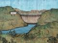
The Renuka Dam Project proposed over the river Giri Ganga (a tributary of the Yamuna) located some 300km away from Delhi, is a joint project of the governments of Himachal Pradesh (HP) and Delhi, to be constructed by the Himachal Pradesh Power Corporation Limited (HPPCL) in Sirmaur district of HP.
Manager- Agriculture and Natural Resource Management
Aga Khan Rural Support Programme (India)
Location: Ahmedabad and intensive traveling