International Water Management Institute (IWMI)
International Water Management Institute (IWMI)
Water resources of Andhra Pradesh - An atlas by VIStA, IWMI and GoAP
Posted on 14 May, 2012 06:25 PMThis atlas on water resources in Andhra Pradesh by International Water Management Institute (IWMI), IWMI-Tata Water Policy Program (ITP), Visual Information Systems for Action (VIStA) and
The impacts of water infrastructure and climate change on the hydrology of the Upper Ganges river basin – A research report by IWMI
Posted on 18 Dec, 2011 07:03 PM The Ganges river system originates in the Central Himalayas, and extends into the alluvial Gangetic Plains and drains into the Indian Ocean at the Bay of Bengal. In the upstream mountainous regions, hydropower is the main focus of development with mega and micro projects either under construction or being planned in both Nepal and India.
After the main river channel reaches the plains, it is highly regulated with dams, barrages and associated irrigation canals. All this infrastructure development and abstractions affects the river’s flow regime and reduces flows, which, in turn, impacts downstream water availability, water quality and riverine ecosystems. Furthermore, there are concerns that climate change is likely to exacerbate the water scarcity problem in the Ganges Basin. Therefore, modeling the hydrology of the basin is critical for estimation, planning and management of current and future water resources.
Mapping drought patterns and impacts: A global perspective – A research report by IWMI
Posted on 26 Oct, 2011 08:11 PMThis study by the International Water Management Institute (IWMI) examines the global patterns and impacts of droughts through the mapping of several drought-related characteristics – either at a country level or at regular grid scales. Characteristics cover various aspects of droughts – from global distribution of meteorological and hydrological drought risks to social vulnerability and indices related to water infrastructure.
Adaptive water resource management in the Lower Bhavani project command area in Tamil Nadu – A research report by IWMI
Posted on 25 Aug, 2011 11:07 PM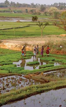
To what extent farmers and water resource managers already practice adaptive management and whether it is practiced in an optimal manner or could there be areas for improvement based on recent advancements in the theory of adaptive management are some of the questions that are particularly appropriate in the light of rapid changes in river basin water use and also in relation to basin closure.
This paper draws on the development and use of water resources in the Lower Bhavani Project (LBP), with the LBP reservoir and the 84,000 hectare (ha) LBP command area. The project diverts water from the Bhavani River, a tributary of the Cauvery River in Tamil Nadu.
Hydrology of the Upper Ganga river – A report by the International Water Management Institute
Posted on 21 Aug, 2011 10:43 PMTo provide the background hydrological information for the assessment of environmental flow requirements at four selected ‘Environmental Flow’ sites, a hydrological model was set up to simulate the catchment in the present state (with water regulation infrastructure) and to generate the natural flows (without water regulation infrastructure).
An assessment of crop water productivity in the Indus and Ganges river basins: Current status and scope for improvement – A research report by IWMI
Posted on 20 Apr, 2011 06:43 PM This approach is based on the integration of readily available remote sensing, national crop productivity and land use statistics and weather data.
Measuring irrigation subsidies in Andhra Pradesh and Southern India: An application of the GSI method for quantifying subsidies – A paper by the International Institute for Sustainable Development (IISD)
Posted on 21 Mar, 2011 08:49 AMThe objectives of the study included: i) assessing the application of a common method for measuring irrigation subsidies in order to develop accurate, replicable and reliable subsidy estimates and ii) providing policy advice aimed at improving and standardizing the reporting of data on irrigation subsidies.
Water poverty in the northeastern hill region of India: Potential alleviation through multiple-use water systems - A report by IWMI
Posted on 20 Dec, 2010 12:07 AM This study by IWMI maps the household water poverty in a typical remote village of the northeast, understands the causes for such a scenario and reflects on the past efforts. Local water resource-based multiple-use water systems that provide water supply both for household and livestock needs and for small high-value agriculture are understood.
The per capita and per hectare availability of water in India is highest in this region but the societal (both productive and consumptive) water use is less than five per cent of the existing potential. The unutilised and excessive water supplies during the rainy season create a mayhem of devastations almost every year with ravaging floods, landslides, soil erosion and other infrastructural failures and miseries and unrest in large parts.
Remote sensing and census based assessment and scope for improvement of rice and wheat water productivity in the Indo-Gangetic basin - A working paper by Challenge Program on Water and Food
Posted on 22 Aug, 2010 04:48 PMThis paper by the Challenge Programme for Water and Food (CPWF) presents a simplified approach to combine remote sensing, census and weather data to analyze basin rice and wheat water productivity (WP) in Indo-Gangetic river basin, South Asia. It presents an innovative approach to combine meteorological data, ground survey, national census with remotely sensed imagery to assess water use, yield, and finally crop water productivity for the Indo-Gangetic rice-wheat cropping system in South Asia.
Resources on water quality, public health and water safety from the World Water Day - UN Water website
Posted on 02 Jul, 2010 01:24 AM The UN-Water website's World Water Day 2010 section, provides access to a range of informative, educational and advocacy material on water.
The documents and publications section includes a range of documents related to water quality, drinking water quality and public health, and water safety planning and management including the safe use of wastewater for agriculture and aquaculture.