Term Path Alias
/sub-categories/data
/sub-categories/data
Floods are common in most parts of India particularly during the monsoon season. Flood control and mitigation involves flood plain mapping, zoning, insuring and warning systems as floods cannot be avoided. These measures minimize damage and loss in terms of life and property. In this regard real-time data based decision supports systems (DSS) are crucial for effective flood management.
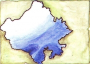 The Water Resources Department of the Government of Rajasthan, has made available, station-level, daily rainfall data from 1973-2008, for all districts of Rajasthan, on its website.
In order to make this data of better value to end-users, the India Water Portal has extracted and made this data available in a district-wise spreadsheet format, which you can download with a single click.
While extracting the data, we observed some discrepancies in the master data on the website. These notes can be viewed here.
Attached here are a series of reports from the Government of Karnataka, providing details of the status and relief activities in the immediate aftermath of the floods in N.Karnataka. The reports contain the following information and more:
Detailed rainfall information for the time period of interest
Loss of human life and livestock,
Damage to houses,
Unrestricted flow, reproduction and redistribution of data has been a great concern with most of the projects and research establishments in India. As we heard the Secretary of Ministry of Water Resources voice his recommendations on the ways to tackle the looming water crisis, and the steps that the ministry is taking towards this, we thought of first putting down the highlights of the talks raw, before we get back to them in a detailed manner.
While we compile together all the presentations and papers, here' s a quick update on the talks from the first day. On the research challenges for improving the use and productivity of natural resources in India, Dr. Anil Singh, Deputy Director General, Natural Resource Management, Indian Council of Agriculture Research had an interesting observation linking fertilizer use with water consumption in the gangetic basin. It is assumed that both of these factors impact the crop productivity and this needs to be explored further.
He suggests:
Two new publications from the IGB project were released today by the Chief Guest at the workshop, U.N. Panjiar, the Secretary to the Ministry of Water Resources, Government of India. Releasing the reports, Mr. Panjiar presented the government's perception of the present water situation along with some statistical data on the water usage. The challenges of food security and water security are global. Climate change has been an increasing concern too. He observes food security, water secutiry and climate change are closely related. The objective of food security cannot be achieved without water security.
U.N. Panjiar releasing the IWMI publications on Indus-Gangetic Basin with Bharat Sharma and Madar Samad

Anil Singh delivering his speech
Mr. Panjiar puts forward the following recommendations, stating that these could possibly help us manage well, the problem of water crisis.
- A comprehensive water database should be developed.
- Assessment of impact of climate change on rescources is required.
- Promotion of citizen and state action for conservation of resources.
- Focus on overexploited areas.
- 15% aquifers in country are overexploite and another 15 are critical. We must increase water reuse by 20%.
- Basin level resource management is essential.
- Irrigation potential crated and irrigation potential utilized must be to the optimal levels.
- In agreement with Simon Cook, he emphasizes that efficiency is an important issue.
- Water, energy and food productivity are closely linked. This relation and interdependence must be explored.
- Remote Sensing techniques are critical in agriculture and basin management.
Government of India has launched a Water Resource Information System and most of the data is being made public under this project! Policy too, is being revised to make most of the data public and it is projected to be launched by the end of current financial year. Launching a National Water Mission of India is also being mulled over. (Read the related documents here)
Stating that it is important to ensure technology transfer to farmers to achieve “more crop per drop” he talks about a project conducted by the ministry in which 5000 demonstrations of relevant farm technologies were given to the farmers. The interim report of this project indicates that use of such technological interventions is important in improving the yield of the crop and improve water efficiency!
Famous quote on Ganges:
"The Ganga, especially, is the river of India, beloved of her people, round which are intertwined her memories, her hopes and fears, her songs of triumph, her victories and her defeats. She has been a symbol of India's age-long culture and civilization, ever changing, ever flowing, and yet ever the same Ganga."
![]()
This report includes the findings of the ASHWAS survey (A Survey of Household Water and Sanitation), a participatory survey carried out by Arghyam, that included 28 districts of Karnataka covering more than 17,200 households across 172 gram panchayats (GPs). This was a peoples' survey, and the surveyors were selected from the respective communities that included students, women from self help groups, local NGO partners and other volunteers.
As part of its committment to provide safe drinking water to its rural communities, the Karnataka State Government as part of its World Bank-assisted Jal Nirmal Yojana program, implemented through the Karnataka Rural Water Supply and Sanitation Agency, took an initiative to adopt a Geographical Information System (GIS) approach to develop a Spatial Information and K
As part of its committment to provide safe drinking water to its rural communities, the Karnataka State Government as part of its World Bank-assisted Jal Nirmal Yojana program, implemented through the Karnataka Rural Water Supply and Sanitation Agency, took an initiative to adopt a Geographical Information System (GIS) approach to develop a Spatial Information and Knowledge base on groundwater quality of Karnataka.
We foresee that this data can be useful in making rainwater harvesting and water balance estimates, in various research areas, climate change adaptation studies and more. We also believe in the democratising effect of having this kind of data freely available to the general public.
The total flood prone region in the country is 40 million Ha, of which about 32 million Ha, can be given protection. Until 1954, only 3 million Ha were protected, while as of 2004, about 15.8 million Ha has been protected. The average annual damage due to floods is estimated at Rs.

