Advanced Centre for Water Resources Development and Management (ACWADAM)
Advanced Centre for Water Resources Development and Management (ACWADAM)
Groundwater management under the climate change scenario in India – A presentation by ACWADAM
Posted on 20 Sep, 2010 08:17 AMThis presentation by ACWADAM deals with the issue of groundwater management under the climate change scenario in India. Climate change is a change in the statistical distribution of weather over periods of time that range from decades to millions of years. The causes are -variations in solar radiations, plate tectonics, volcanism and change in earths orbit & axis.
Aquifer properties – A presentation by ACWADAM
Posted on 20 Sep, 2010 07:37 AMThis presentation on aquifer properties by ACWADAM deals with the storage and transmission properties of aquifers. The two functions of an aquifer, accumulation of water (storage) and flow of water (transmission) are discussed. The permeability or hydraulic conductivity of the aquifer which allows water to flow towards the well is described.
Earth System: Interactions Part II – A presentation by ACWADAM
Posted on 20 Sep, 2010 06:43 AMThis presentation by ACWADAM on earth system deals with the interactions between the four elements that make up this system. The complexity of the earth system, in which spatial and temporal variability exists on a range of scales, requires that an organized scientific approach be developed for addressing the complex, interdisciplinary problems that exist.
Earth System: Introduction (Part I) - A presentation by ACWADAM
Posted on 19 Sep, 2010 07:00 PMThe presentation by ACWADAM on earth system deals with the four elements that make up this system. Earth science generally recognizes four spheres, the lithosphere, the hydrosphere, the atmosphere, and the biosphere; these correspond to rocks, water, air, and life. These four interdependent parts or the earth's spheres are described as:
- the lithosphere, which contains all of the cold, hard, solid rock of the planet's crust (surface), the hot semi-solid rock that lies underneath the crust, the hot liquid rock near the center of the planet, and the solid iron core (center) of the planet
- the hydrosphere, which contains all of the planet's solid, liquid, and gaseous water,
- the atmosphere, which contains all of the planet's air, and
- the biosphere, which contains all of the planet's living organisms.
Hydrologic properties of rocks – A presentation by ACWADAM
Posted on 19 Sep, 2010 06:22 PMThis presentation by ACWADAM deals with hydrologic properties of the rock framework in which groundwater occurs and through which it moves. In watershed programmes, it is necessary to develop a correct understanding of the storage and transmission of water within such channels because the shape of openings in a rock or sediment, their size, volume and interconnection play a vital part in the hydraulic characteristics of an aquifer.
Groundwater management protocols and pilot experiences – A presentation by ACWADAM
Posted on 19 Sep, 2010 05:09 PMThis presentation by ACWADAM deals with introducing groundwater management protocols for wells in different phases of groundwater use. These protocols include geo-hydrology in watershed development, protection of recharge areas, efficient well use, pump capacity regulation, distance with respect to drinking water well regulation, depth regulation in drinking water well, regulation of agricultural water use and groundwater management through sharing.
Vertical distribution of groundwater – A presentation by ACWADAM
Posted on 12 Sep, 2010 01:22 PMThis presentation by ACWADAM explains the occurrence of groundwater and deals with the vertical distribution of groundwater. To begin with, the openings in rocks in the zone of rock fracture such as intergranular openings, vesicles in volcanic rock, joints & fractures and solution cavities are described.
Why study weather – A presentation by ACWADAM
Posted on 12 Sep, 2010 11:03 AMThis presentation by ACWADAM deals with weather, the most fundamental process that shapes the earth. Meteorology, the science of studying weather, is described where some predictions can be made using atmospheric conditions or some data can be generated using simple equipments. These can in turn be used for measurement of weather for better implementation of a watershed project.
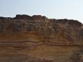
Type of rocks – A presentation by ACWADAM
Posted on 11 Sep, 2010 08:07 PMThis presentation by ACWADAM deals with the three basic types of rocks that are found in nature – igneous, sedimentary and metamorphic. Rocks are classified on the basis of minerals & chemical composition, by texture and by the processes that formed them.
Rapid investigations to assess impacts of aquifer recharge - Tumkur district (Karnataka) - A report by ACWADAM and BIRD-K
Posted on 01 Sep, 2010 02:19 PM This report by ACWADAM is a synopsis of the hydrogeological study carried out for BIRD-K in Pavagada, Sira and Bagepalli areas of Tumkur District, Karnataka. The study aimed at an impact analysis of recharge through borewells as well as suggesting new sites for the same.
The principle objectives of the study were:
- Impact analysis of aquifer recharge through borewells done by BIRD-K in Pavagada and Sira Clusters
- Suggest new sites for aquifer recharge through borewells in Bagepalli cluster.
The methodology used a background study of the area through images from Google Earth. A detailed geological fieldwork in the area was carried out. Various structural and hydrogeological measurements were made to map out the aquifer systems within the area. Water levels in borewells and dug wells were measured. The study area included seven watersheds and falls in two clusters namely Pavagada and Sira. Both these clusters are located in the Tumkur district of Karnataka.